


Birch Point #1
Size of Tent Pads: 8-12x12
Distance to Office/Boat Landing: 3 Miles to office, 5 to Haines landing
GPS Coordinates: 44 54'28.9"N
70 49'42.4"W
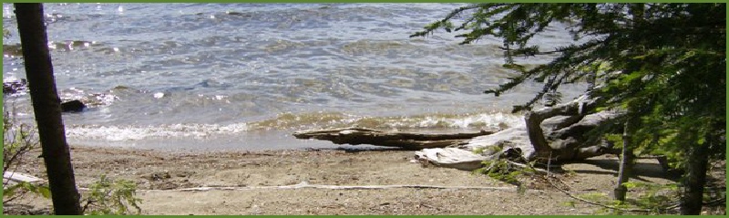
Shoreline: Rocky with patches of small pebbles
Boat Access: Go straight in towards the fireplace, the water is deep and there are no obstructions until your half a boat length from shore.
Description: This is an enormous site. If you can’t fit here, then you won’t fit anywhere. The site has 2 picnic tables to accommodate groups, and flat tent pads abound. This is lightly wooded site with plenty of raspberry and blackberry bushes. Views include the southern and eastern shores of the lake, Student’s Island and the sunrise. The water is deep off the eastern side for easy boat access and shallow on the southern side for swimming.
Birch Point 1 & 2
-17.JPG)
-17.JPG)
.JPG)
-9.JPG)

-18.JPG)
-19.JPG)
-15.JPG) Return to Campsites
Return to Campsites
Birch Point #2
Size of Tent Pads: 12x12
Distance to Office/Boat Landing: 3 Miles to office, 5 to Haines landing
GPS Coordinates: 44 54'28.6"N
70 49'46.9"W
Shoreline: Rocky with patches of small stone
Boat Access: Be aware of buoys when approaching from the lake. Be alert for submerged rocks within 100 feet of shore.
Description: This site provides protection from the wind and a soft, mossy tent pad. The site is well separated from Birch #1 and receives sun nearly all day as it is in a small clearing. The site is 50 from the water, but the shoreline provides views of the southern area of Mooselookmeguntic.