


Ramble
Size of Tent Pads: 16x16 10x10
Distance to Office/Boat Landing: 2 ½ Miles to office, 4 miles to Bemis boat lunch, 6 ½ to Haines landing
GPS Coordinates: 44 53’43.0”N
70 49’55.1”W
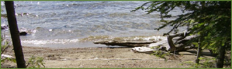
Shoreline: Pebbles and small stones with some sand
Boat Access: Easy landing on small stones, watch for submerged rocks on the way in; land to the right of the sign on to avoid rocks, it’s the best spot.
Description: This site provides unparalleled views of the southern shore of Mooselookmeguntic, the Height of the Land, the Bemis Range, and Elephant Mountain. This site is private, receives sunlight in the morning and afternoon, is within 2 miles of the dam, and is protected from the prevailing wind directions.
Ramble
-17.JPG)
-10.JPG)
-4.JPG)
-21.JPG) Return to Campsites
Return to Campsites